If your method of data collection involves Drones you'll have some photogrammetric software which will produce a Point Cloud with RGB colours. From this point, that's where LSS can help.
Using LSS Vista with Point Clouds or LSS Elite with Point Clouds you can transform that data into a DTM, digitise breaklines - realtime and in 3D - direct from the Point Cloud into LSS.
 Import large datasets in E57, LAS or LAZ - these files must be in cartesian coordinates (i.e. XYZ) and not Lat. Long.
Automatically remove outlying points
Eraser tool and filter box to interactively remove unwanted points
View the point cloud in 3D and vertical or horizontal Slice
Extract a DTM into LSS, restricted by user-defined 'filter box' or 'Surface features' in LSS at a user-defined grid interval (lowest, highest or mean height)
Intelligently 'thin' the data to extract a quality-assured DTM which contains fewer points
Digitise breaklines visually and in realtime from the Point Cloud using World's first "SearchphereTM" technology to find highest, lowest, mean, closest to click, closest to eye or furthest from eye
"Find Edge" engine to discover breaklines as the cursor is moved around the Point Cloud
EdgeStreamTM technology can trace a string along a well-defined intersection of two planes, such as a kerb, wall or channel
"Find Plane" engine to report slope direction, and pitch and provide statistical analysis as the cursor is moved around the Point Cloud
Over-display the lines, points and triangles from an LSS survey in the Point Cloud in 3D and Slice view
Access to the powerful reporting, design and editing tools available in either LSS Vista or LSS Elite (depending on the package chosen)
Distribute Point Cloud and LSS survey to clients for them to view in the free LSS 3D VisionTM application
Technical support and advice direct from time-served surveyors and engineers and the whole LSS development team.
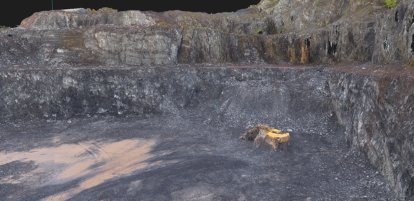
A Point Cloud derived from a Drone Survey and viewed inside LSS 3D VisionTM - courtesy DroneSurv.com
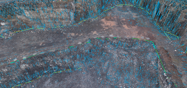
DTM and breaklines created in LSS and overdisplayed in LSS 3D VisionTM
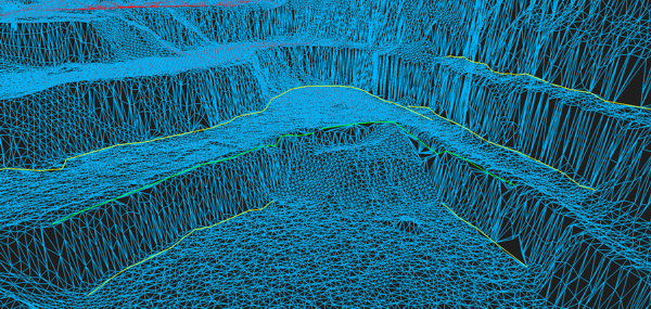
The DTM and breaklines displayed in LSS 3D VisionTM
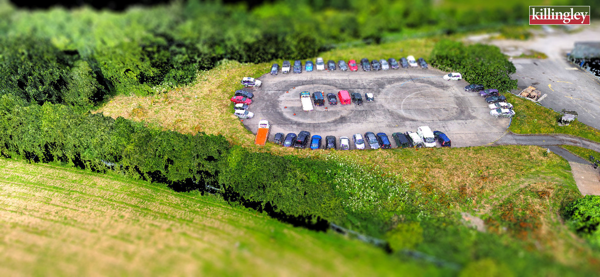
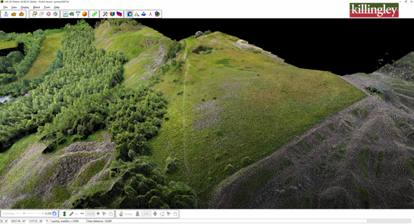
Point Clouds derived from UAV surveys by N T Killingley