 All LSS products will produce a triangulated digital terrain model (DTM). This triangular mesh is at the heart of everything we do in LSS and isn't even a separate command. As soon as any data is loaded into LSS it is modelled. The user can then choose to display contours at any interval. The triangles and contours are dynamic and react instantly to changes to the points that make up the DTM. If the data from which the DTM was created contained feature codes (lines and coded points) then these can be set to be inside the DTM or not. One thing you may notice about LSS is that it automatically trims the DTM, so you're not left with loads of long, thin triangles on the outside of the DTM which should never have been created.
Depending on your chosen LSS product, in addition to DTM creation, you may wish to report volumes, design excavations, calculate level differences etc. Please see the products section for details.
Import data from a variety of sources, including survey instruments, DXF, LandXML, GENIO, ASCII XYZ, Point Clouds (some import options are not available in all products)
Automatically generate a DTM of up to 4.08million points, usually within seconds
DTM automatically trimmed to reduce instances of redundant triangles on the outside of the model
Optional data thinning to reduce the number of points in the DTM to quality-assured standards
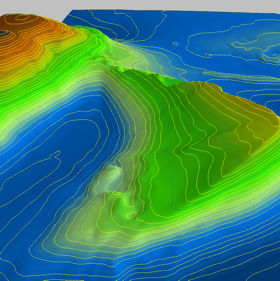
Contour at any interval with choice of colours
Dynamic DTM and contours which change as points within the DTM are added, removed, moved or altered
Add new links straight into the DTM with a choice of level interpolation
Transform the DTM in 3 dimensions (rotate, shift, raise, lower, re-scale)
Display height banding and background imagery such as map or aerial photo
Display slope arrows
Cut and paste DTMs (LSS Vista and Elite)
Drape one DTM onto another (LSS Elite only)
3D visualisation with textures, height bands or drape imagery (LSS Vista and Elite)
Apply 'surface features' to groups of triangles to control contouring, DTM creation and for reporting areas and volumes etc (volumes only available in LSS Vista and Elite)
DTMs created from radial EDM survey data remain tied to survey stations, so Traverse adjustment and setup changes affect the DTM in realtime.
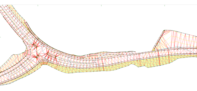
Automatic trimming of triangles along the edge of the DTM.
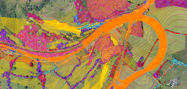
Large and complex DTMs all possible in LSS.
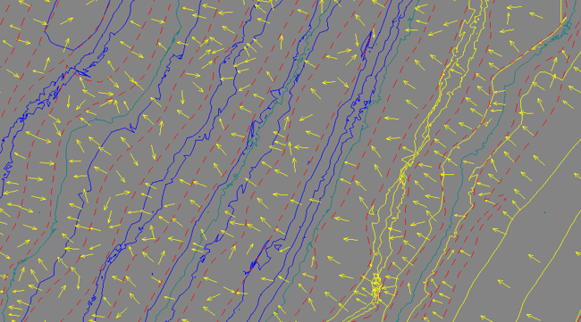
Slope arrows and lines forming breaklines in this DTM of a quarry.